
69 zigzag curves leading to the sky
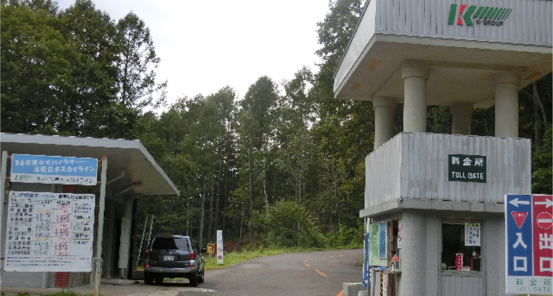
Tsugaru Iwaki Skyline is located in “Tsugaru Quasi-National Park” and opened on August 25, 1965 as the first toll road in Aomori Prefecture. You can drive through the winding road with 69 tight curves surrounded by the bounties of nature that stretches from past Dake Onsen on Prefectural Road 3 “Hirosakidake-Ajigasawa Line” (near Haguro Onsen-go) to the 8th station of Mt. Iwaki. ※Click here for the highlights of Tsugaru Quasi-National Park
When approaching the end point, the scenery becomes more and more magnificent, you can see a panoramic view, Matsumae in Hokkaido to the far north, Oshima and Kojima in the folk song “Esashi Oiwake”, Cape Gongenzaki and Lake Jusanko on the Tsugaru Peninsula, Sitirinagahama coast that draws a gentle arc, view from Ajigasawa to Odose, etc.). Its dynamic view is known as one of the most spectacular scenery among toll roads in Japan.
“Tsugaru Quasi-National Park” offers a variety of natural scenery, including Mt. Shirakami, which is part of the World Natural Heritage Site Shirakami-Sanchi, Juniko Lake including Aoike, and coastal terraces such as Takanosaki and Oto Sezaki. ※Click here for the highlights of Tsugaru Quasi-National Park
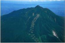
Tsugaru Iwaki Skyline opened on August 25, 1965 as the first toll road in Aomori Prefecture. You can drive through the winding road with 69 tight curves surrounded by the bounties of nature that stretches from past Dake Onsen on Prefectural Road 3 “Hirosakidake-Ajigasawa Line” (near Haguro Onsen-go) to the 8th station of Mt. Iwaki.

From late July until late September, we extend opening hours so that visitors can appreciate the sunset over the Japan Sea at the 8th station of Mt. Iwaki.
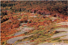
From late September until mid-October, the leaves of Japanes beech and oak, from green, turn red, or yellow, or orange, adding additional charm to the Tsugaru Iwaki Skyline.

As you get closer to the 8th station of Mt. Iwaki, the landscape becomes more and more magnificent. You can see a panoramic view, Matsumae in Hokkaido to the far north, Cape Gongenzaki and Lake Jusanko on the Tsugaru Peninsula, Sitirinagahama coast that draws a gentle arc, view from Ajigasawa to Odose, etc.).
Contact
- Company:Iwaki Skyline Co., Ltd.
- TEL:0172-83-2314
- Address:56-2 Kuromori, Tokiwano, Hirosaki City, Aomori
- Email:info@iwaki-skyline.jp
- Click here for the official site
Section
- Starting point
- 177 Kamikurosawa, Tokiwano, Hirosaki City, Aomori

- End point
- 1-1 Iwakisan, Hyakuzawa, Hirosaki City, Aomori
Fee
- Motorcycle (over 125cc)
- 1,200 yen
- Light / Ordinary car
- Light car 1,700 yen
- Ordinary car 2,000 yen
- Minibus/ Local Buses
- 5,000 yen
- Large car
- 8,000 yen
Access
| Via Apple Road from Tohoku Expressway Owani-hirosaki IC | 33km (45min) |
||||
| Tsugaru Iwaki Skyline | |||||
| From Tsugaru Expressway Tsugaru-kashiwa IC | 37km (50min) |
||||
| Tsugaru Iwaki Skyline | Towada-Hachimantai National Park | |

Recommended drive route 1
- Point1
- Iwaki Skyline (via outbound route of Mt. Iwaki Loop Line)
40㎞
(54min)
- Point2
- Iwakisan Shrine (via Apple Road)
15㎞(25min)
- Point3
- Sukayu Onsen/Mt. Hakko
Recommended drive route 2
- Point1
- Iwaki Skyline
24㎞
(34min)
6㎞
(17min)
- Point3
- Lake Tsugaru-shirakami
10min on foot
- Point4
- Anmon Waterfall